
Fountain's Verified ZIP 80817
The research verified standard postal ZIP code 80817 for the Fountain postal city and Fountain Post Office. The office is at 101 S. Santa Fe Avenue, Fountain, CO 80817-1920, with a posted phone of 719-382-4623. Postal geography can reach beyond the incorporated city polygon, so the address guide should state what is verified and what remains unconfirmed.
| ZIP | Area or post office | Post Office | Notes |
|---|---|---|---|
| 80817 | Fountain postal city | Fountain Post Office, 101 S. Santa Fe Ave. | May include delivery addresses outside the exact city polygon; validate a full address |
| Other ZIPs | Not verified as Fountain municipal ZIPs | Not listed without a live crosswalk | Do not label adjacent postal areas as Fountain city coverage from assumption |
The research did not verify 80911, 80913, 80925, or 80816 as Fountain municipal ZIP codes. A complete USPS and city-limit crosswalk would be needed before adding them. This restraint is useful: a postal guide should not turn neighboring labels into a local resident list.
For the current postal source, use the Fountain Post Office listing and then validate a known address with the USPS lookup.
Fountain ZIP Boundaries and City Lines
A postal code is a delivery geography. Fountain's incorporated boundary is a municipal polygon. El Paso County parcels and tax districts are another map. A postal city label can sit on an address outside a city line, while a county record can describe a Fountain parcel with a mailing city that looks different. The postal guide must keep those labels side by side instead of treating one as proof of the others.
Compare a USPS return with the Assessor situs, county GIS parcel geometry, Fountain city-limit layer, and any recorded annexation plat or inclusion order. The city map carries a disclaimer about incomplete or inaccurate layers. A legal boundary question belongs with the recorded instrument or responsible custodian. A ZIP result can standardize delivery and still leave municipal status unresolved.
Boundary check. The USPS result tells how an address is served. County and city records tell where the parcel sits. A resident or owner conclusion needs a separate record source.
USPS Address Checks for Fountain ZIP
The USPS ZIP Lookup has three useful modes. By Address returns a standardized ZIP for a known place. By City and State helps inspect postal city choices. Cities by ZIP Code works in the other direction. None confirms a person or company at an address, so it belongs before a parcel or record search, not in place of one.
| Mode or field | Type | Required | Fountain use |
|---|---|---|---|
| Company | Text | Optional | Use only when a company line is part of the known address |
| Street Address | Text | Required for address mode | Enter number and street |
| Apt/Suite/Other | Text | Optional | Add a secondary address when known |
| City | Text | Required for address mode | Try Fountain as the postal city named on the record |
| State | Dropdown | Required | Choose Colorado |
| ZIP Code | Text | Optional | Constrain or return a postal code |
| Find | Button | Action | Return standardized postal information |
| City and State / Cities by ZIP | Separate modes | Mode-specific | Check postal labels, not municipal residency |
The USPS disclaimer is important for any Fountain postal search: a returned ZIP does not confirm a person or company at the address. Save the complete address and result, then check the county situs.
Note: USPS standardizes delivery for a known address; county records still decide the parcel and municipal questions.
Find Fountain Residents by ZIP
A ZIP code directory workflow can narrow an address set without pretending that a public ZIP-wide resident roster exists. Use the ZIP as one filter, then select a record system that actually supports the next question. For a current parcel, use the Assessor and GIS. For projects, use PPRBD. For a person's own registration, use the SOS form. For historic households, use a library directory or street guide.
- Verify the full address or postal city with USPS, keeping 80817 separate from the city-limit question.
- Check county GIS and the Assessor situs to identify the parcel and its legal description.
- Use PPRBD's map ZIP filter when the question concerns permits, plans, projects, or districts.
- Use the Colorado voter form only for an individual first name, last name, ZIP, and birthday match.
- For an older household, search PPLD directories, rural runs, phone books, maps, or NewsFinder by year and address.
If the question narrows to one named street, move to the Fountain street directory by address. That page owns the parcel, deed, permit, and historical street-chain work. The ZIP reference should stay at the geographic filtering level.
Fountain ZIP Code Filters in Permit Maps
PPRBD is the clearest local example of a ZIP-capable portal in the research. Its public map accepts ZIP Code along with permit date, project type, project code, project description, jurisdiction, valuation, total area, fire, water, sanitation, school, commissioner, city council, address range, street direction, street name, street type, and city. The address form itself uses street fields, parcel number, or latitude and longitude and does not expose a ZIP field in the same way.
- ZIP filter result
- Permit and plan map records matching the map's data and postal field.
- Parcel filter result
- Projects tied to a county parcel identifier.
- City filter result
- Map records labeled for a city, which may not settle a municipal boundary dispute.
- Resident meaning
- None by itself. A project party or contractor remains a project connection.
The PPRBD address search is the source for address, parcel, permit, plan, archived-card, and floodplain routes.
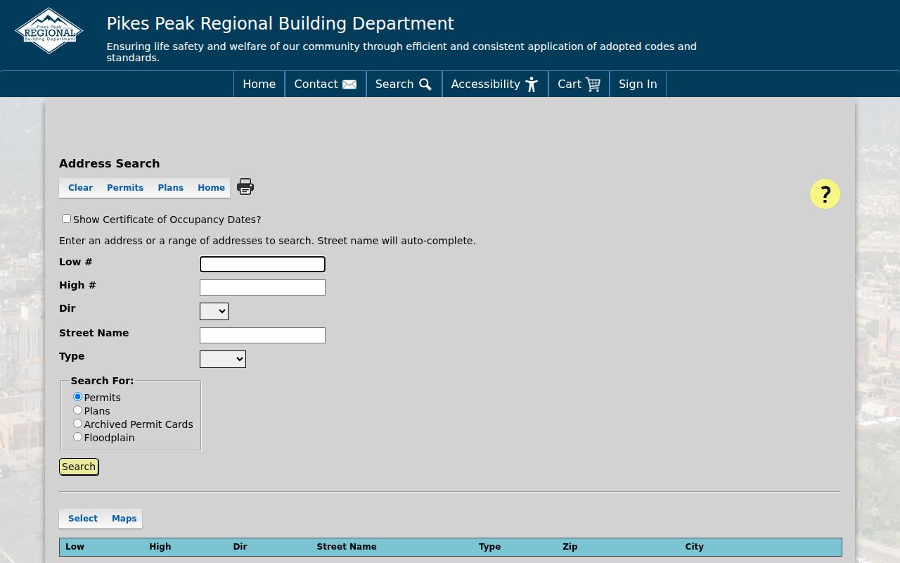
A permit map can show the kind of ZIP-capable local record that is available. It should not be repurposed as a household directory.
Fountain Situs, Mailing, and Postal Labels
Three address terms often explain a confusing Fountain postal result. The situs address marks the physical parcel used by the Assessor, GIS, and many permit searches. The mailing address receives tax notices and can be elsewhere. The postal city and ZIP describe delivery. A legal description identifies the land through a lot, block, plat, or survey when the street name is old or unclear.
- ZIP code
- A USPS delivery area used to sort and standardize mail; it is not a city-limit polygon.
- ZIP+4
- An extended delivery code that can narrow mail routing beyond the five-digit ZIP; it does not identify a household.
- PO-box ZIP
- A ZIP associated with a post-office box or delivery route rather than a physical parcel address.
- Unique ZIP
- A postal code assigned to a particular organization or delivery pattern, not a claim about all nearby parcels.
- Carrier route
- A delivery route within postal geography that helps mail service but does not create a public resident list.
When these labels disagree, preserve all of them and carry the parcel number to county records. Do not replace a legal description with a guessed ZIP or postal city.
Fountain Street Names Before Modern ZIP
Historical Fountain-area addresses predate the current postal system and may use older street names or a reversed odd-even number. PPLD documents street changes during the 1870s through 1917. A city directory, rural directory, Sanborn map, plat, tapping record, or newspaper may use Colorado Springs, Colorado City, Manitou Springs, or a rural El Paso label instead of modern Fountain.
Search the old and new street names, a cross street, and the library's street guide before assuming that a missing ZIP match means the address never existed. Once the historical location is understood, compare it with the county legal description and parcel geometry. The modern postal lens cannot correct a historical address by itself.
Note: A historical source should be quoted with its own city heading and year before it is translated into a current postal code.
Fountain ZIP Annexation and Tax Layers
Fountain parcels near a city edge can carry more than one geography. City tax-entity maps are built from inclusion and exclusion orders, annexation plats, and ordinances recorded with the Clerk. County GIS can show city limits, neighborhoods, wards, zoning, utilities, and public-safety or fire layers. A postal label may stay the same while a municipal, utility, or ward context changes.
For a boundary question, identify the parcel, inspect the city and county map layers, and request the recorded annexation or map record from the proper office. The address guide should report the postal fact and direct the reader to the legal-land route. It should not infer city membership from 80817 alone.
The county parcel service is available through the El Paso GIS parcel map, while city map layers carry a local-data disclaimer.
The parcel image shows why a ZIP, parcel, and municipal boundary need to be read as separate layers.
What a Fountain ZIP Code Search Returns
A postal search returns an address standardization or city-and-state relationship. A permit map returns projects that match its filters. The voter tool returns an individual match, not a ZIP-wide name list. The Assessor may return parcels if its live page supports the selected mode, but the exact ZIP behavior was not exposed in the research and should not be assumed. County GIS returns polygons and layers rather than a resident roster.
This distinction keeps the ZIP code directory useful. It can help a reader validate an address, compare postal and municipal geography, narrow a permit map, or choose a parcel workflow. It cannot show every household in 80817 and cannot prove that a person is at a delivery address.
| Portal | ZIP or address behavior | Meaning of a result |
|---|---|---|
| USPS | Full address, city/state, or ZIP-to-city modes | Postal delivery information |
| PPRBD map | ZIP, street, city, district, project, and address filters | Permit or plan map record |
| SOS voter lookup | ZIP plus first, last, and birthday | Individual registration match |
| County GIS | Parcel geometry and map layers | Land and district geography |
| Assessor | ZIP behavior not confirmed in text inspection | Verify live before claiming a ZIP-wide parcel search |
Fountain ZIP Access Fallbacks
If the online postal search does not answer the question, the fallback depends on the record. USPS can help with a known full address. County GIS or the Assessor can resolve a parcel. PPRBD can answer a defined permit or plan question. The City Clerk or Planning office can route an annexation, address-assignment, or map-layer request. PPLD's street guides, directories, Sanborn maps, and historical atlases can bridge an older label.
For a current record, request a specified address, parcel, date, or map layer rather than an unbounded list. Under Colorado's public-records framework, the custodian may redact or withhold protected information and is not required to create a new ZIP-wide resident directory. The proper question is “which office holds this record and what field identifies it?”
Privacy boundary. ZIP geography can narrow a place, but it does not open private delivery, utility, DMV, protected voter, vital, or household information. Use a postal result only for a defined lawful purpose.
Note: The verified 80817 association is enough to validate a known Fountain postal address, not enough to list every nearby city or household.